

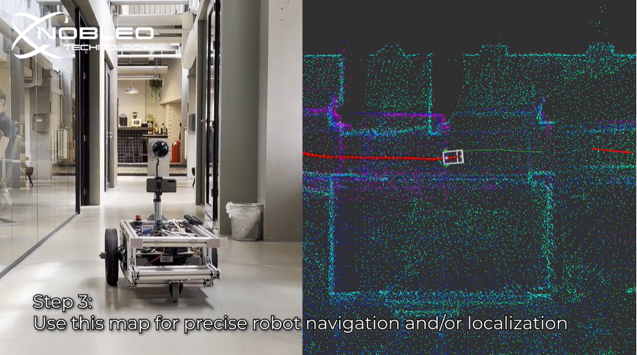
SLAM stands for Simultaneous Localization and Mapping: the process of building a map of an environment while tracking your position within it. Nobleo SLAM can use data from a 3D LiDAR create an accurate 3D map of the environment. This map could enable precise navigation for robotics, logistics, or inspection applications. Read more [Picture from video bij Nobleo Technology on linkedin.com]